New York City Wind Speed: Unraveling Its Blustery Urban Secrets
New York City, a global metropolis, often presents a unique meteorological paradox: moments of surprising calm juxtaposed with sudden, powerful gusts. Understanding the average wind speed New York City experiences is crucial for urban planners, engineers, and even daily commuters navigating its formidable landscape. This complex dynamic is heavily influenced by the city's distinctive built environment, particularly its towering skyscrapers which can generate an intense urban canyon effect, funneling air into powerful currents. Advanced tools like the anemometer are vital for collecting precise meteorological data, helping experts analyze these intricate airflow patterns and predict their impact on the urban fabric.
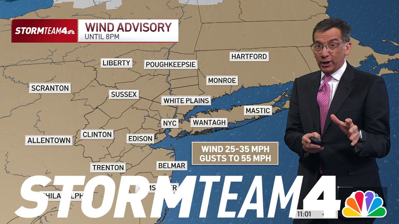
Image taken from the YouTube channel NBC New York , from the video titled Dangerous wind gusts up to 55 MPH triggers advisory across tri-state | NBC New York .
New York City, a global icon of ambition and innovation, is defined by its towering skyscrapers and the bustling energy of millions. From the historic brownstones of Greenwich Village to the stratospheric heights of Hudson Yards, its unique urban tapestry creates a complex interplay with the natural elements. Among these, wind stands out as a deceptively simple yet profoundly impactful force, shaping everything from daily commutes to the very design of the city's future.
The Critical Importance of Wind Dynamics in an Urban Environment
Understanding wind speed in a dense metropolis like New York is far more than a meteorological curiosity; it's a fundamental pillar of urban resilience, safety, and liveability. For the city's nearly 8.5 million residents and countless visitors, wind isn't just a weather condition; it's a dynamic force that can significantly influence pedestrian comfort, create treacherous conditions, or even impact the structural integrity of buildings. Think of the sudden, powerful gusts that can turn a pleasant stroll into a challenging walk, or the amplified winds between buildings that create notorious "urban canyons." These aren't random occurrences but predictable phenomena resulting from the city's unique geography and built environment.
Unpacking the Interplay: Geography, Meteorology, and Engineering
This article delves into the intricate mechanisms that define New York City's distinctive wind profile. We will explore how its urban geography – the density of its skyscrapers, the layout of its streets, and its coastal proximity – acts as a colossal wind modifier, channeling, accelerating, and disrupting airflow. Concurrently, we will examine the meteorological factors at play, from regional weather patterns to the thermodynamics of the urban heat island effect, all contributing to the city's atmospheric dance. Finally, we will consider the crucial role of structural engineering in mitigating wind's impact, designing buildings that not only withstand formidable forces but also contribute to a safer, more comfortable urban experience for those on the ground. By unraveling these interconnected elements, we aim to shed light on the unseen currents that continuously sculpt the very air of New York City.
Having established the critical importance of understanding wind dynamics in New York City, we now peel back the layers to explore the fundamental forces that generate wind and how a dense metropolis profoundly reshapes these natural dynamics.
The Urban Dynamics of Wind Speed
At its core, wind is simply air in motion, a complex dance orchestrated by the atmosphere's constant quest for equilibrium. However, once this natural phenomenon encounters the intricate labyrinth of a modern city, its behavior undergoes a dramatic transformation. This section delves into the foundational principles of wind generation and how an urban landscape, particularly one as uniquely structured as New York's, acts as a powerful modifier of these atmospheric forces.
The Genesis of Wind: Atmospheric Pressure Differences
The primary driver of all wind on Earth is the differential heating of the planet's surface by the sun. This uneven heating creates variations in atmospheric pressure. Think of it this way: warmer air is less dense and tends to rise, creating areas of low pressure. Conversely, cooler air is denser and sinks, leading to areas of high pressure.
Nature abhors a vacuum, or in this case, a pressure imbalance. To restore equilibrium, air naturally flows from zones of high pressure to zones of low pressure. The greater the difference in pressure over a given distance—what meteorologists call the pressure gradient—the stronger the force pushing the air, and thus, the faster the wind blows. For instance, a typical sea-level pressure is around 1013.25 millibars (hPa), but even small deviations and gradients over distances can generate significant air movement. Other factors like the Earth's rotation (the Coriolis effect) also influence wind direction, but the fundamental impetus remains the search for pressure balance.
Urban Alterations: Reshaping Natural Wind Patterns
Imagine wind flowing freely over an open plain—it's a relatively smooth, laminar flow, dictated primarily by large-scale pressure systems. Now, introduce a sprawling urban landscape filled with towering structures. Suddenly, that smooth flow is disrupted, fragmented, and redirected.
The transition from a natural environment to an urban one fundamentally alters wind patterns in several key ways:
- Increased Surface Roughness: Buildings, trees, and other urban features create immense friction, dramatically increasing the "roughness" of the landscape. This friction slows down wind speeds, especially at lower altitudes.
- Turbulence Generation: Instead of smooth flow, wind encounters obstacles and breaks into chaotic, swirling eddies and gusts. This turbulence is a hallmark of urban wind, making it far more unpredictable and gusty than in open areas.
- Deflection and Channeling: When wind collides with a large building, it doesn't simply stop. It's deflected around, over, and sometimes even down the structure. This leads to channeling effects, where wind is funneled between buildings, often accelerating in the process, much like water through a narrow pipe.
Buildings as Airflow Modifiers: Setting the Stage for Urban Wind Phenomena
Every building within a city acts as a distinct aerodynamic obstacle, profoundly modifying local airflow. This interaction gives rise to a range of specific urban wind phenomena that are critical to understand in a dense environment.
For example, when wind strikes the face of a tall building, it can be forced downwards, creating intense downwash at street level. Conversely, wind can be accelerated between buildings, leading to pronounced wind tunnel effects or what are often termed "urban canyons." Around the corners of structures, especially tall ones, vortex shedding can occur, generating powerful, swirling gusts. The cumulative effect of thousands of such interactions across a city creates a highly localized, dynamic wind environment, often vastly different from the broader regional wind conditions. Understanding these principles is essential, as they lay the groundwork for comprehending the unique wind challenges posed by specific architectural designs, a topic we will explore in detail when examining New York City's distinctive skyline.
Having explored the fundamental principles of wind generation and how urban environments generally reshape atmospheric flows, we now narrow our focus to New York City's distinctive architectural elements. The city's unique blend of grid-planned streets and towering structures acts not merely as a backdrop, but as an active participant in modifying wind patterns. This dynamic interaction creates unique microclimates and powerful localized wind effects, significantly impacting everything from pedestrian comfort to the structural integrity of buildings.
New York City's Architectural Influence on Wind: Urban Canyons and Skyscrapers
The Anatomy of Urban Canyons in NYC
New York City, particularly Manhattan, is characterized by its meticulously planned grid system of streets and avenues. When tall buildings line both sides of these thoroughfares, they create what are known as urban canyons. These narrow, canyon-like spaces are pervasive across the city, forming a defining feature of its urban fabric. Unlike open, flat terrain where wind moves relatively unimpeded, the confined spaces of urban canyons force air into a restricted pathway.
The Channeling Effect: Wind's Accelerated Path
This physical constriction leads to a phenomenon known as the channeling effect (or Venturi effect). As wind enters an urban canyon, it is funneled and compressed, causing its speed to increase significantly. Imagine a river flowing through a wide plain suddenly forced into a narrow gorge; the water accelerates. Similarly, wind speeds within New York's urban canyons can often be 20% to 50% higher than in more open areas just above the rooftops, especially when the wind direction is aligned with the canyon's axis. This effect is particularly pronounced along long, unobstructed avenues and cross-streets, turning seemingly gentle breezes into powerful gusts.
Skyscrapers: Formidable Obstacles and Wind Shapers
Beyond the street-level canyons, New York City's iconic skyline—dominated by thousands of high-rises and over 300 skyscrapers exceeding 150 meters (492 feet) in height—introduces another layer of complexity to wind dynamics. These towering structures act as formidable, blunt obstacles to incoming airflow. When wind encounters a skyscraper, it can no longer flow smoothly. Instead, it is forced to deviate, creating a complex pattern of high-pressure zones on the windward side and low-pressure zones on the leeward side.
This interaction generates several distinct wind phenomena around individual buildings:
- Updrafts: Air pushed upward along the building's face.
- Downdrafts: Air forced downwards to street level, often creating intense gusts, particularly at building corners or near entrances.
- Turbulence: Chaotic, swirling air patterns generated as wind flows around and over the building, leading to unpredictable gusts.
The "Wind Tunnel Effect" Between Closely Spaced Skyscrapers
The problem intensifies when multiple skyscrapers are built in close proximity, a common sight in dense areas like Midtown Manhattan or the Financial District. The narrow gaps between these colossal structures can create an exaggerated channeling effect, often referred to as the wind tunnel effect. Here, the wind is not just channeled; it's accelerated dramatically as it squeezes through the confined spaces.
This effect can transform seemingly calm days into challenging experiences for pedestrians, generating localized gusts that can exceed ambient wind speeds by a considerable margin, sometimes making walking difficult or even hazardous. For instance, specific street corners or plazas hemmed in by multiple towers are notoriously windy spots.
Localized Microclimates: A Tapestry of Wind Speeds
The combined influence of urban canyons and towering skyscrapers results in the creation of highly localized microclimates across New York City, each with its own distinct wind characteristics. One block might be relatively sheltered and calm, while the next, due to a specific building configuration or street alignment, experiences persistent, strong gusts.
This spatial variability in wind speed is a critical consideration for urban planners, architects, and everyday New Yorkers. It influences everything from the placement of outdoor cafes and public seating areas to the design of pedestrian-friendly pathways. Understanding these architectural influences is key to comprehending the intricate and often surprising ways wind behaves within the concrete jungle of New York City.
Having explored how New York City's distinctive architecture molds the flow of wind, creating unique microclimates and powerful localized effects, the natural next step is to understand how these complex wind patterns are actually measured. Accurately capturing wind speed in such a dynamic urban environment is crucial for everything from building design to public safety. This section delves into the scientific methods, the specialized tools, and the extensive data networks employed to monitor and analyze wind speed across the city's incredibly varied terrain, alongside the inherent challenges of this intricate task.
Measuring New York City's Wind Speed: Tools, Data, and Challenges
Understanding New York City's intricate wind profile demands precise measurement and comprehensive data. This section will detail the meteorological science, the instruments, the network of weather stations, and the organizations involved in accurately capturing and analyzing wind speed data across the city's varied terrain, along with the inherent challenges of this task.
The Science of Meteorology in an Urban Context
Meteorology, the scientific study of the atmosphere and its phenomena, faces unique complexities in dense urban environments like New York City. Traditional meteorological models often assume relatively uniform terrain, but cities present a jagged landscape of skyscrapers and urban canyons that drastically alter wind flow, temperature, and humidity. Urban meteorologists must account for these microclimates and localized effects to provide accurate forecasts and analyses. This involves understanding how buildings induce turbulence, channel winds, and create areas of calm or high velocity.
Key Instruments: The Anemometer
The primary tool for measuring wind speed is the anemometer. This essential meteorological instrument translates the kinetic energy of moving air into a measurable value. While various types exist, the most common include:
- Cup Anemometers: These feature three or four hemispherical cups mounted on horizontal arms that rotate in the wind. The speed of rotation is directly proportional to the wind speed. They are robust and widely used.
- Vane Anemometers: Often combined with a wind vane to indicate wind direction, these utilize a propeller that spins as wind passes through it, measuring its velocity.
- Sonic Anemometers: These advanced instruments use ultrasonic sound waves to measure wind speed and direction with high precision and no moving parts, making them ideal for turbulent urban environments where rapid fluctuations occur.
Each anemometer provides critical data, typically reporting wind speed in miles per hour (mph), kilometers per hour (km/h), or knots. Their accurate calibration and strategic placement are paramount for reliable readings.
The Network of Weather Stations in and around New York City
To paint a comprehensive picture of wind speed across such a diverse landscape, New York City relies on a robust network of weather stations. These stations are strategically located to capture data from various environments:
- Airport Locations: Major airports like LaGuardia (LGA), JFK International (JFK), and Newark Liberty International (EWR) host official weather stations. These provide crucial surface wind data that impacts aviation and general regional weather. For example, JFK Airport's open exposure often reports higher average wind speeds compared to central Manhattan.
- Rooftop Stations: Many tall buildings across Manhattan and the outer boroughs feature rooftop anemometers. These locations provide valuable data on winds at height, which can differ significantly from ground-level readings due to reduced friction and channeling effects. Data from the National Weather Service's observation site in Central Park, while not rooftop, provides a key urban park measurement.
- Coastal Stations: Sites along the city's extensive coastline, such as at Coney Island or Governors Island, capture maritime wind speeds and their interaction with the urban edge, which can be influenced by sea breezes and coastal storms.
- Specialized Networks: Research institutions and private entities also operate smaller, localized networks to study specific urban phenomena or provide micro-scale data for urban planning and engineering.
This distributed network is essential because a single reading cannot represent the vast differences in wind speed experienced across New York City's varied geography.
Data Sources: The Crucial Role of the National Weather Service
The National Weather Service (NWS) plays a pivotal role in monitoring and forecasting wind speed for New York City and the surrounding region. The NWS's local office in New York, NY, collects data from its extensive network of official weather stations, including airports and other government-operated sites.
The NWS utilizes this raw data, combined with radar, satellite imagery, and advanced atmospheric models, to:
- Issue daily forecasts: Providing predictions for wind speed and direction across the metropolitan area.
- Issue warnings: Alerting the public to high winds, damaging gusts, or other hazardous conditions that could impact infrastructure or public safety.
- Archive historical data: This invaluable resource allows researchers, engineers, and urban planners to study long-term trends, assess climate impacts, and design structures that can withstand anticipated wind loads.
- Disseminate information: Through NOAA Weather Radio, the NWS website, and partnerships with local media, ensuring public access to critical wind speed information.
Their comprehensive approach ensures that New York City receives timely and accurate wind intelligence.
Challenges of Obtaining Representative Wind Speed Data in Varied Urban Terrain
Despite sophisticated instruments and extensive networks, obtaining truly representative wind speed data in a highly varied urban terrain like New York City presents significant challenges:
- Microclimates: The most prominent challenge is the sheer prevalence of microclimates. As previously discussed, urban canyons can create powerful channeling effects, increasing wind speed dramatically at street level, while simultaneously creating calm zones just a block away. Skyscrapers can generate intense downward drafts or wind tunnel effects between buildings, leading to highly localized gusts that may not be captured by a distant weather station.
- Obstruction and Turbulence: Buildings act as formidable obstacles, creating complex patterns of turbulence, vortices, and eddies that defy simple measurement. A single anemometer on a rooftop might show consistent wind, while street-level conditions below are chaotic.
- Variability with Height: Wind speed generally increases with height due to less friction from the ground and buildings. A ground-level measurement might be 5 mph, while at 500 feet, it could be 25 mph or more, making it difficult to define a single "city wind speed."
- Sensor Placement: Finding truly representative sites for anemometers is difficult. Placing them too close to a building can skew readings, while placing them too far away might miss critical localized phenomena. Even within seemingly open areas like Central Park, surrounding buildings can influence airflow.
These complexities mean that while general wind speed forecasts are provided, actual conditions on any given street corner or between specific skyscrapers can vary wildly from official readings, underscoring the dynamic and localized nature of New York City's atmospheric interactions.
Having explored the intricate methods and challenges involved in measuring New York City’s diverse wind profile, the logical next step is to understand why those measurements often reveal such dramatic variations. The city's unique blend of natural geography and towering urban development creates a complex interplay of forces that shape localized wind conditions.
Factors Influencing Localized Wind Speed in New York City
New York City's wind patterns are far from uniform; they are a mosaic of localized conditions influenced by a fascinating interplay of large-scale weather phenomena and the intricate details of its built environment. Understanding these factors is crucial for everything from pedestrian comfort to structural engineering and even air quality management.
Large-Scale Weather Systems and Urban Interaction
The primary drivers of wind across any region are large-scale weather systems, particularly the movement of high and low atmospheric pressure systems. High-pressure systems typically bring stable air and lighter winds, while low-pressure systems are associated with more turbulent conditions, stronger winds, and often precipitation. When these synoptic-scale winds, which might be relatively uniform over open terrain, encounter the dense, vertical landscape of New York City, their behavior changes dramatically.
The city's formidable skyline acts as a massive obstacle course. Incoming winds are either blocked, channeled, or deflected by the towering structures. This interaction generates significant turbulence, especially near the ground, leading to rapid fluctuations in both wind speed and direction. A steady regional breeze can transform into highly variable gusts and lulls within just a few city blocks, a phenomenon well-documented in urban meteorology studies.
Topographical Influences and Microclimates
Beyond the immediate impact of buildings, New York City’s fundamental topography plays a critical role in shaping its localized winds and fostering distinct microclimates. Surrounded by the Atlantic Ocean, the Hudson River, and the East River, the city experiences significant maritime influences. Sea breezes, driven by the temperature difference between land and water, can provide welcome cooling in summer but also introduce moisture and alter wind directions, particularly in coastal and riverside neighborhoods.
The varied elevations across the boroughs also contribute. For instance, areas like Washington Heights in Manhattan or parts of Staten Island, which sit on higher ground, can experience less shielding from buildings and thus higher average wind speeds compared to lower-lying areas. The presence of large open spaces, such as Central Park, also creates localized wind patterns, often acting as low-resistance channels for wind, increasing speeds within and along their perimeters compared to surrounding dense urban canyons. These varied landscapes within the relatively small area of NYC lead to the formation of multiple, distinct microclimates, each with its own unique wind characteristics.
Building Heights and Orientations: Creating Wind Zones
Perhaps the most iconic influence on New York City's wind is its architectural density and diversity. The sheer number, varying heights, and diverse orientations of buildings create an incredibly complex three-dimensional environment that directly manipulates wind flow, leading to pronounced zones of both high and low wind speed.
- Urban Canyon Effect: When wind flows down a street lined with tall buildings, it gets compressed and accelerated, much like water through a narrow pipe. This is known as the urban canyon effect and can lead to significantly higher wind speeds at street level than what might be recorded just above the rooftops or in open areas. This acceleration is often most pronounced at intersections, where winds can swirl unpredictably.
- Wind Shadowing: On the leeward (downwind) side of tall buildings, particularly very wide ones, areas of significantly reduced wind speed or even calm can form. This wind shadowing effect creates sheltered zones but can also lead to air stagnation and poor pollutant dispersion.
- Corner Effects: Wind accelerating around the corners of tall buildings can create powerful, localized gusts, sometimes referred to as "corner jets." These can be particularly hazardous for pedestrians and impact building design considerations.
The intricate tapestry of New York City's buildings means that walking just a few blocks can take one from a relatively calm, sheltered street into a powerful wind tunnel, demonstrating the profound influence of urban design on the very air we breathe.
Having explored the intricate factors that shape localized wind speeds across New York City's complex urban tapestry, from macro-scale atmospheric pressure systems to the microclimates sculpted by towering skyscrapers, we now turn our attention to the profound implications these wind dynamics have on the very structures that define its skyline. Understanding where and how wind behaves is merely the prelude to addressing what it means for the city's enduring infrastructure.
Impact of High Wind Speed on New York City's Infrastructure
New York City, a testament to human ingenuity and ambition, stands as a dense collection of some of the world's most iconic and structurally complex infrastructure. From its soaring skyscrapers that pierce the clouds to its massive bridges spanning vital waterways, every structure must contend with significant environmental forces, chief among them high wind speeds. The integrity of this infrastructure is paramount not only for daily operations but, more critically, for public safety and the city's economic resilience.
Structural Considerations for Skyscrapers Under High Wind Speed Loading
New York City's skyline is a forest of skyscrapers, each an engineering marvel designed to resist immense lateral forces exerted by wind. Unlike static loads, wind imposes dynamic loads that can fluctuate rapidly in both magnitude and direction, creating complex pressures and suctions on a building's surfaces. Tall buildings, by their very nature, act like giant sails, catching these forces.
Engineers must account for phenomena like vortex shedding, where alternating vortices form on the leeward side of a building, causing oscillatory forces that can induce sway. For example, One World Trade Center, standing at a symbolic 1,776 feet (541 meters), is designed to withstand extreme wind events, including hurricane-force winds. Its robust core, composed of high-strength concrete and steel, is engineered to provide substantial stiffness and resistance to torsional forces.
Many modern supertalls also incorporate sophisticated solutions such as tuned mass dampers (TMDs). These massive pendulum-like devices or hydraulic systems, often weighing hundreds of tons, are strategically placed near the top of a building. They are designed to oscillate out of phase with the building's natural sway, effectively dissipating kinetic energy and significantly reducing perceptible motion for occupants during high winds. Buildings like 432 Park Avenue, despite its slender profile, incorporate such advanced damping systems to ensure occupant comfort and structural integrity. Extensive wind tunnel testing is a mandatory part of the design process for skyscrapers over 200 feet in NYC, allowing engineers to simulate wind conditions and predict structural responses with remarkable precision.
The Engineering Challenges and Safety Measures for NYC Bridges Exposed to Extreme Wind Speed
New York City's bridges, from the historic Brooklyn Bridge to the massive Verrazzano-Narrows Bridge, are vital arteries connecting boroughs and facilitating the flow of millions daily. These long-span structures, particularly suspension and cable-stayed bridges, are inherently flexible and thus highly susceptible to wind forces. The infamous 1940 collapse of the Tacoma Narrows Bridge (not in NYC, but a pivotal case study) due to aeroelastic flutter—a destructive self-induced oscillation caused by wind—served as a stark lesson for bridge engineers worldwide.
Modern bridge design in NYC rigorously addresses these aerodynamic challenges. Engineers employ advanced computational fluid dynamics (CFD) and extensive wind tunnel testing of bridge models to understand potential aerodynamic instabilities. Designs incorporate features that promote aerodynamic stability, such as open trusswork or aerodynamic fairings, to prevent dangerous oscillations. For instance, the George Washington Bridge, a key crossing, is regularly inspected and monitored, with engineers constantly assessing its structural health.
Safety measures extend beyond initial design. Many of NYC's major bridges are equipped with structural health monitoring systems, deploying arrays of sensors that track vibrations, deflections, and strain in real-time. This continuous data allows engineers to assess the bridge's performance under various loads, including high winds, enabling proactive maintenance and, if necessary, temporary closures to ensure public safety. For example, during severe weather events, authorities may temporarily restrict certain vehicles or even close bridges entirely if wind speeds pose an unacceptable risk.
The Need for Robust Structural Engineering to Ensure the Integrity of Infrastructure in New York City
The relentless push for resilience in New York City's infrastructure underscores the critical role of robust structural engineering. The city's Building Code, influenced by standards like ASCE 7 ("Minimum Design Loads and Associated Criteria for Buildings and Other Structures"), mandates rigorous design criteria for wind resistance. Structures are not simply built to withstand average conditions but are engineered for extreme events, often requiring design to resist wind speeds with a long return period—meaning events expected to occur only once in several hundred years (e.g., a 700-year event for essential facilities).
This proactive approach ensures that buildings and bridges can endure not only everyday gusts but also powerful storms and hurricanes, which are an increasing concern given climate change. Beyond individual structures, the concept of urban resilience focuses on the interconnectedness of infrastructure systems. A failure in one area, such as a power grid compromised by wind-damaged transmission lines, can have cascading effects across the entire city.
Therefore, robust structural engineering encompasses more than just strength; it also includes redundancy, durability, and the ability to recover quickly after an event. It's a continuous process of research, innovation, and adaptation, ensuring that New York City's iconic infrastructure remains a symbol of safety, stability, and enduring strength against the forces of nature.
The pervasive challenge of high wind speeds on New York City's infrastructure, particularly its iconic skyscrapers and crucial bridges, demands not just acknowledgment but sophisticated solutions. Recognizing the profound impact detailed previously, the city's architectural and engineering communities have spearheaded innovative approaches to ensure resilience against powerful gusts. This section delves into the cutting-edge strategies employed in building design and advanced structural engineering that fortify New York City's structures against the elements.
Designing for the Wind: Building Design and Structural Engineering Solutions
Recognizing the challenges posed by urban winds, this section explores the innovative solutions employed by architects and engineers to mitigate adverse wind effects. We will examine modern building design strategies and advanced structural engineering techniques that make New York City's structures resilient against powerful gusts.
Modern Building Design Strategies to Mitigate Adverse Wind Effects
Architects and designers are increasingly employing aerodynamic principles to shape buildings in ways that reduce wind forces and improve urban wind environments. Unlike older, boxier structures, many contemporary designs feature intricate geometries aimed at disrupting or deflecting strong winds.
- Shaping and Orientation: The most direct approach is to manipulate the building's form. Tapered tops, chamfered corners, and sculpted facades are not merely aesthetic choices; they are calculated measures. For instance, a tower that narrows towards its apex can significantly reduce vortex shedding – a phenomenon where swirling eddies of wind create oscillating forces that can cause buildings to sway. Similarly, rounded corners or twisted forms can help smooth airflow around the structure, distributing wind pressure more evenly across the facade and minimizing concentrated loads. This also extends to the building's orientation on its site, strategically aligning it to present the least resistant face to prevailing strong winds where feasible.
- Porous Designs and Voids: Some modern designs incorporate large openings or sky gardens within the building's mass. These strategically placed voids can allow wind to pass through the structure, reducing the overall pressure exerted on the building and mitigating downwash effects at street level, which can create uncomfortable wind tunnels for pedestrians.
Advanced Structural Engineering Techniques for Wind Resistance
Beyond external shaping, the internal skeletal systems of skyscrapers and other large structures in New York City rely on highly sophisticated engineering techniques to withstand immense wind loads.
- Stiffening Systems: Tall buildings combat lateral wind forces through robust core systems. Many modern NYC skyscrapers utilize shear walls – reinforced concrete walls that extend from the foundation through much of the building's height, providing significant stiffness. Outrigger trusses, another common technique, connect the central core to the perimeter columns at various levels, effectively widening the building's base for resisting overturning forces and distributing wind loads more efficiently throughout the structure.
- Damping Technologies: To mitigate the perception of sway and reduce stress on structural elements, many supertall buildings incorporate damping systems. The most famous is the tuned mass damper (TMD), a massive pendulum or a system of weights, springs, and hydraulic cylinders located near the top of the building. For example, the former Citigroup Center (now 601 Lexington Avenue) in Manhattan was one of the first skyscrapers to incorporate a TMD, though its primary purpose was seismic rather than wind. Modern TMDs in buildings like the 111 West 57th Street tower are specifically calibrated to counteract a building's natural frequency of oscillation caused by wind, reducing sway by up to 30% or more and significantly improving occupant comfort.
- High-Performance Materials: The use of advanced materials, such as high-strength concrete and steel alloys, allows engineers to design leaner yet incredibly strong structural elements capable of handling the extreme stresses imposed by high winds.
The Use of Wind Tunnel Testing in the Design Phase
For any new significant development, particularly skyscrapers and large-span bridges in New York City, wind tunnel testing is an indispensable step in the design process. This rigorous evaluation goes far beyond theoretical calculations, providing invaluable empirical data.
- Predictive Analysis: Scaled models (typically 1:400 to 1:500) of the proposed building and its surrounding urban context are placed in specialized wind tunnels, simulating various wind speeds, directions, and turbulence profiles specific to the site. Sensors embedded in the model measure the actual pressures and forces exerted on the building's envelope and structure. This allows engineers to accurately predict peak wind loads, design more precise facades, and ensure the structural integrity under extreme conditions, such as those during a Category 1 hurricane.
- Optimization and Pedestrian Comfort: Beyond structural safety, wind tunnel tests also assess pedestrian-level wind comfort. They identify areas around the building where high-speed wind gusts might create uncomfortable or hazardous conditions, allowing designers to implement mitigation strategies like canopies, landscaping, or strategically placed windbreaks. This proactive approach ensures that new developments not only withstand the wind but also contribute positively to the urban environment at ground level. This testing is crucial for projects like One Vanderbilt, helping to refine its design for both structural resilience and a comfortable public plaza.
Frequently Asked Questions About NYC Wind
What is the average wind speed in New York City?
The average annual wind speed in New York City typically ranges between 10 and 15 miles per hour (16-24 km/h), though this can vary significantly by specific borough and time of year. This gives a general idea of the common wind speed New York City experiences.
Why does New York City often feel so windy?
New York City's perceived windiness is due to a combination of factors, including its coastal location, the funneling effect of its grid-like street layout, and the "urban canyon" effect created by tall buildings. These structures can accelerate and channel wind, making the wind speed in New York City feel more intense at street level.
What are the highest recorded wind speeds in NYC?
During major storms, such as hurricanes or severe nor'easters, the wind speed in New York City can exceed 70-80 miles per hour (113-129 km/h) in gusts. While high, sustained winds of this magnitude are less common than strong, temporary bursts.
How do skyscrapers impact wind speed in the city?
Tall skyscrapers create unique aerodynamic effects. They can cause wind to accelerate around their bases, known as the "downwash" effect, or create turbulent eddies and updrafts. This significantly alters the localized wind speed New York City experiences at pedestrian level, often leading to gustier conditions.
Ultimately, appreciating the nuances of wind speed New York City reveals a fascinating interplay between urban design and atmospheric forces. Keep an eye on the forecast and stay aware of those blustery urban secrets!
Related Posts:
- The Secret of 88 Central Park West New York: Luxury Unveiled
- Unlock NYC News: Your New York Newspapers List & Guide Today!
- Sex and the City New York Locations: Your Ultimate Fan Guide
- Discover 380 2nd Ave NYC: Hidden Gems & Area Secrets Revealed!
- Norfolk to New York: The Ultimate Travel Guide – Choose Your Path!
